
The town of Nederland was incorporated 150 years ago, on February 10, 1874. The town was called Nederland as a tribute to the Dutch owners of “The Mining Company Nederland,” who had always
This item is available in full to subscribers.
At this time, we ask you to confirm your subscription at www.themtnear.com, to continue accessing the only weekly paper in the Peak to Peak region to cover ALL the news you need! Simply click Confirm my subscription now!.
If you are a digital subscriber with an active, online-only subscription then you already have an account here. Just reset your password if you've not yet logged in to your account on this new site.
Otherwise, click here to view your options for subscribing.
Questions? Call us at 303-810-5409 or email info@themountainear.com.
Please log in to continue |
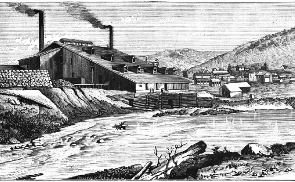
The town of Nederland was incorporated 150 years ago, on February 10, 1874. The town was called Nederland as a tribute to the Dutch owners of “The Mining Company Nederland,” who had always referred to the small village known as Middle Boulder as Nederland, which means “lower lands” in Dutch.
The history of Nederland is intertwined with a tradition of independence forged from the rich legacy of Nederland’s mining heritage. The Great Caribou Silver Lode, west of Nederland, was discovered in 1864. It was not the first silver camp discovered in the Colorado Territory, but for more than a decade, it was the queen of Colorado’s silver camps. From 1900 to 1918 Nederland was by far the leading producer of tungsten in the United States. The Eldora Gold-Telluride mining boom, peaking in 1897, disintegrated by 1899.
Around 1680, the Utes (linguistic kin of the Comanche) moved south of Wyoming to avoid the Sioux in the Dakotas. For many years, the Utes lived peacefully in the mountains and foothills of northern Colorado. During the summer they hunted elk in the high country and crossed the Continental Divide over the well-traveled “Ute Trail” to Middle Park, west of Nederland. The Ute Trail began at Sulphide Flats east of Eldora, traversed up the eastern ridge of Spencer Mountain, and traveled along Bryan Mountain across the Eldora ski area to Rollins Pass near the Needles Eye tunnel and then over the Continental Divide to Middle Park.
French fur trappers traded with the Utes in the 1840s and ’50s. What would become the town of Nederland was undoubtedly visited by some of the first prospectors to venture into the headwaters of the rivers and creeks of what was known as the “Snowy Range” during the winter of 1859. The first prospectors named what is now western Boulder County the Grand Island Mining District, and the first gold mining claims were filed in 1861. These early prospectors were on the lookout for gold, not silver, telluride, or tungsten.
Placer gold was discovered during the spring of 1859 at what was called the “Jefferson Diggings” in the gravels along Middle Boulder Creek near present day Nederland. Not much is known about the Jefferson Diggings except that three men were killed by a forest fire there in 1860.
Calvin Ward established Ward in 1861, which soon became the most productive mining camp in Boulder County. The gold-rich oxidized ore treated at the Niwot Mill may have produced close to $9,000,000.
Only mule or pony packs could travel up Boulder Canyon, so supplies for Ward and the other mining camps in the region had to come from Central City and Black Hawk. A small group of cabins appeared in a meadow along the wagon road between Central City and Ward, adjacent to Middle Boulder Creek. The group of cabins became known as Dayton. The glaciated valley offered level pasture land with abundant water and rich soil where vegetables could be grown and livestock raised to feed the hungry miners and supply local prospectors in the quickly growing mining camps of the area.
Sometime in 1864, Samuel Conger (who many years later discovered the Nederland Tungsten District) was hunting for deer near Arapahoe Peak when he wandered across some interesting looking rocks (legend has it he was shown the rocks by the ghost of a beautiful Arapaho Princess). Samuel Conger decided to show his rock samples to two experienced Gilpin County miners, William Martin and Hugh McCammon. William Martin had worked in the silver mines of the Comstock Lode in Nevada and he recognized immediately that the rocks contained rich silver ore. Conger made a grubstake agreement with William Martin, George Lytle, Hugh McCammon, John Pickel, and Samuel and Harvey Mishler to find the source of the silver-rich rock samples.
As soon as the snow melted in 1869, William Martin and George Lytle followed pieces of silver ore in the creek and later on the ground all the way to the discovery outcrop (blossom rock) at the top of a hill. On the north side of this hill, on August 31, 1869, they discovered the weathered outcroppings of two silver veins. William Martin named one of the veins the Carriboo vein, and ,considering his current financial condition, George Lytle named the other vein, the Poor Man vein. George Lytle decided to name the new camp Caribou, after the famous Caribou mining district in British Columbia. He may have chosen the name because above timberline, Caribou resembles the tundra of the Arctic.
During the fall of 1869 there was no trail up the mountain, and supplies had to be carried mostly by hand over huge snow drifts and downed trees. On the last day of summer, they managed to pack out some rock specimens to Professor Nathanial Hill’s smelter in Black Hawk for assay to verify the value of the ore. They wanted to keep the discovery secret, so they did not file the Carriboo lode claim in the Boulder County Courthouse until December 23, 1869, and they waited until March 26, 1870, to file the Poor Man claim.
Despite their efforts, word of the discovery spread quickly, and by June of 1870 a stampede began for the new mining district. Soon, 300 to 400 prospectors arrived in the meadow below Caribou Hill. They camped under trees, pitched tents, and built brush houses. This camp became the site of the town of Caribou, and by November 1870 it had about 30 houses and 125 voters. The wooded meadow would never be the same, and Caribou would reach a maximum population of 540 later in the decade.
During the fall of 1870, three wagons, each carrying two tons of silver ore, would make the trip from Caribou to Black Hawk every day to be milled, and the wagon road to Black Hawk passed through Dayton.
In 1870, Nathan W. Brown filed for a 40-acre agricultural homestead and built a two-story boarding house in Dayton that he called Brown’s Mountain House. He was given the nickname of “Bolly Brown,” probably because he was bald, and rather round in stature. Old Bolly must have been a likable character because Dayton soon became known as Brownsville, Browns Ranch, or Browns Station. John Pickel of Black Hawk erected a hardware and grocery store in Dayton near Brown’s hotel. Many other dwellings were erected that summer.
In the fall of 1870, Abel D. Breed, a wealthy capitalist from Cincinnati, purchased the western half of the Caribou lode for $50,000.
During the following summer, some of the richest lodes were uncovered at Caribou. “Not a day passes but that some fortunate one makes a strike on new veins on northside of Caribou hill. The whole hill seems packed with these parallel veins (Caribou Post, July 8, 1871).” That summer there were multiple fires in the dry grass near Caribou. The July 4th dance was held at Cardinal.
In the summer of 1871, the Caribou shaft was 185 feet deep, and the miners sorted the high-grade ore in the shaft house of the mine. This first-class ore contained from $1,000 to $5,000 per ton of silver. The Caribou vein expanded from two to six feet thick, and contained mostly silver glance (Argentite, AgS) with very little lead.
A. D. Breed was offered $1,000,000 for the Caribou Mine by an investor from England, but he refused to sell (Caribou Post, July 22, 1871).
The White River Utes claimed Middle Park and they did not allow any new houses to be built (Caribou Post, August 9, 1871).
A corner lot in Boulder that sold for $500 in 1869, sold for $2,500 in 1871.


