
NEDERLAND - The Native American history of the area known as Nederland today is truly unique and goes back thousands of years. The Ute trail west of Nederland was the route used by Prehistoric Native Americans to access the largest alpine game...
This item is available in full to subscribers.
At this time, we ask you to confirm your subscription at www.themtnear.com, to continue accessing the only weekly paper in the Peak to Peak region to cover ALL the news you need! Simply click Confirm my subscription now!.
If you are a digital subscriber with an active, online-only subscription then you already have an account here. Just reset your password if you've not yet logged in to your account on this new site.
Otherwise, click here to view your options for subscribing.
Questions? Call us at 303-810-5409 or email info@themountainear.com.
Please log in to continue |
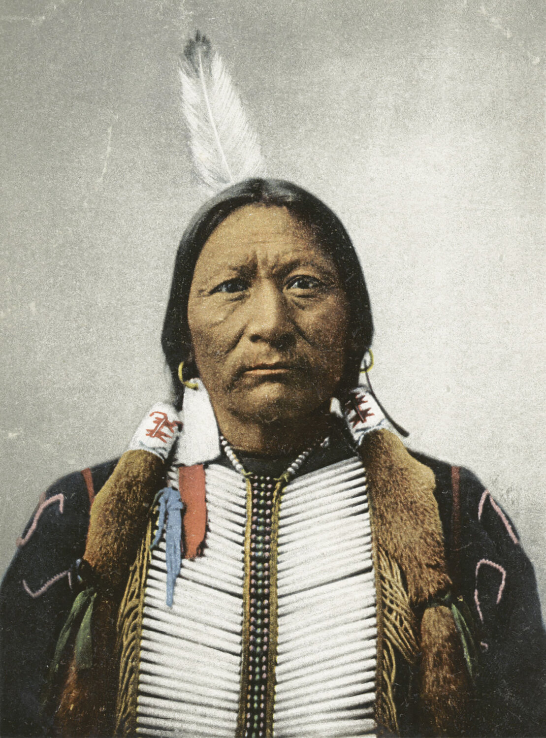


NEDERLAND - The Native American history of the area known today as Nederland is truly unique and goes back thousands of years.
The Ute trail west of Nederland was the route used by Prehistoric Native Americans to access the largest alpine game drive complex known in Northern Colorado at Rollins Pass. The site has been described as “one of the greatest concentrations of ancient hunting structures documented in North America.” (Pelton, 2012)
The meadows of western Nederland were likely important staging areas for access to Rollins Pass. Considering the importance of Rollins Pass as a sacred Native American hunting location, it is not unreasonable to assume that many Native Americans, including prominent historic Ute chiefs, may have camped west of Nederland.
Corona or Rollins Pass is a saddle across the Continental Divide that has allowed human and animal migration from the Front Range to Middle Park for millennia. The 6,000-year-old Paleoindian hunting ground is sacred to the Ute and Arapaho Native American tribes. Rollins Pass is considered a sacred area for both the Nuuchu (Ute) and the Nookhose’iinenno (Arapaho) Native Americans.
Rollins Pass forms a low saddle along the Continental Divide where it is possible to ride a horse across the range. Rollins Pass straddles the boundaries among Boulder, Grand, and Gilpin Counties of the Colorado Front Range. It separates the headwaters of tributary drainages of the South Platte and Colorado Rivers, two of the principal drainages in the state.
For many years, the Utes lived peacefully in the mountains and foothills of northern Colorado. During the summer they hunted bighorn sheep, deer, and elk in the high country and crossed the Continental Divide over the well‐traveled “Ute Trail” to Middle Park west of Nederland.
The Ute Trail began in Boulder, near Sunshine Canyon, traversed just south of Sugarloaf Mountain, and up Gordon Gulch to Cold Springs, then across Caribou open space to Sulphide Flats west of Nederland, just east of Maysville and the town of Eldora.
The trail traversed up the eastern ridge of Spencer Mountain, along the north side of Peterson Lake, and traveled westerly following Ute Ridge up Bryan Mountain over what is now the Eldora ski area to Rollins Pass near the Needle’s Eye tunnel and then over the Continental Divide to Middle Park.
Some of the first French fur trappers that traded with the Utes in the 1840s and ’50s established a trading post close to what would become the town of Nederland. The town of Nederland was incorporated on February 10, 1874.
In 1873, three years before Colorado’s statehood, John Quincy Adams Rollins constructed a toll wagon road over Rollins Pass. He reported the recovery of a weathered wooden bow from the ridge above Rollins Pass, demonstrating the late use of the game drive site.
“At the summit of this pass are what, upon careful investigation, I conclude are the remains of an ancient settlement or battle-ground. Here are stone walls, two or three miles in length, compact and regular and giving every evidence that they were built by human hands.
“The walls are not so high as farmers now use to enclose or subdivide their farms, being only one or two feet high. Near by, and on either side of the walls, are numerous rock pits, round, and from one to four feet deep and from four to eight feet across the top.
“In [a] stone corner of the field I found a bow, about three feet in length, made from hemlock wood, and having the appearance of great antiquity. The grain of the wood is worn from the bow fully a quarter of an inch deep leaving knobs protruding.” (Rollins, 1873)
The early interpretations of these rock walls on Rollins Pass ranged from monuments, to battlefields, settlements, and hunting systems. Nearly a century would go by before what was known by fur trappers and the earliest pioneers, including John Quincy Adams Rollins, would be formally described to modern Archeological standards by Byron Olson and James Benedict in 1967, and later by Jason M. LaBelle and Spencer R. Pelton in 2013.
At least 45 stone blinds, 1,307 meters of rock walls and numerous cairn lines have been documented along the Continental Divide, at altitudes above 11,000 feet on Rollins Pass west of the Needle’s Eye Tunnel in the James Peak Wilderness.
Both radiocarbon and lichenometric (measuring the rate of lichen growth) dating suggest occupation by Native Americans spanning the last 3,200 years, with projectile point styles and ethnohistoric information documenting at a minimum four periods of occupation spanning the past 6,000 years. (LaBelle and Pelton, 2013)
The hunting system was already in use during the Late Archaic period, from 1881 - 798 BCE and 1135 - 798 BCE. Rock wall construction continued during CE 655 - 1125 during the Ceramic Period. The most intensive use of the site began in the Late Prehistoric to Protohistoric period, from CE 1671 – 1869. (LaBelle and Pelton, 2013)
These dates suggest the site does not represent a hunting event that can be linked to a single era or climatic event. The site was constructed and remodeled over at least three millennia (and perhaps several more), and it served an important role in the seasonal use of the high country by Native American foragers.
Rock walls, blinds, pits, and cairns are numerous and five types of chipped stone tools, 44 projectile points or point fragments, and the only basin metate (a stone grinding tool used for food production) are thus far recorded from the Colorado Front Range high country. (LaBelle and Pelton, 2013)
The stone grinding tool was transported from a sandstone quarry source in the foothills, a trek of no less than 30 km with at least 2000 m of elevation gain.
The hunting blinds consist of excavated pit features surrounded by rock walls that allowed the hunters to conceal themselves as the animals were driven toward them. Excavations in the hunting blinds have shown that people had indeed been in them, as dropped items and tool sharpening flakes have been found.
Native American hunters stationed themselves along the Continental Divide during the seasonal migrations of large game, likely in the early to middle fall. The hunters prepared tools during downtime and watched for signs from scouts located to the west and upwind from the rock walls.
Small hearths were built on the floors of blinds, warming the inhabitants while they waited for the game. Stone grinding tools indicate that the Native American groups were processing alpine plant foods or perhaps foods derived from adjacent lowland areas. (LaBelle and Pelton, 2013)
The Ancient rock wall alignments are remarkably similar to the inuksuit built by Inuit hunters to help guide reindeer to a desired hunting ground.
Evidence suggests a slow, controlled hunt from which only a few animals were selectively taken, as opposed to a stampede of large game driven to the kill site. (LaBelle and Pelton, 2013) As the animals moved east into the grazing area, additional bands of hunters created a disturbance, initiating the drive.
Moving down the prevailing wind direction to the southeast, and up the slope, the animals could not see anything but skyline, and the walls would lead the game towards the hidden hunters waiting in the shooting pits at the top of the ridgeline. Many walls lie along the top of the Continental Divide.
In this case, the Rollins Pass fences would function as sort of a reverse buffalo jump: instead of driving the game off a cliff, they would drive them up towards a confined space where they would be ambushed.
Although the animals would have easily been able to step or jump over the low walls, their natural instincts made them follow the walls until they reached an opening and instead of finding freedom, they would encounter groups of hunters waiting in the blinds.
The main blinds are often found in pairs, with one being on each side of the wall. Other blinds are scattered around the wall to allow other hunters to harvest the stragglers or escaped animals.
The Ute People have oral traditions going back hundreds, maybe thousands, of years, indicating that their origin was possibly here in Colorado. Many of the Utes believe that the tribe descended from the ancient native people who inhabited western Colorado’s deserts as long as 3,000 years ago.
There is evidence that the Utes have ancient roots in Mexico and shared ancestors with the Aztecs. Though it may not be clear precisely when the Ute people came to Colorado or how they got here, they may have lived here longer than anyone else.
One of the early names for the Ute People was “the blue sky people.” Another was the “people of the shining mountains.” When Europeans first saw present-day Colorado in the early 1500s, most of it was Ute territory, and had been for centuries. Spanish chronicles called them “Yutas,” the forever ago people.
The Northern Arapaho tribe of Native Americans occupied what is now Wyoming, and the Southern Arapaho lived in what was Colorado. When they first reached the Rocky Mountains (about 1750), they encountered the Utes, who would not allow them access to the mountains. So, the Southern Arapaho mostly settled in the South Platte River Valley.
Before 1868, the southern band of Utes that called themselves the Mouache Utes ruled the eastern slope of the Rockies, from Denver south to New Mexico. Chief Ouray, the principal chief of the western, Uncompahgre band of Utes, named Sapiah, was also commonly known as Charles Buck or Buckskin Charlie, chief of the Mouache Utes around 1870.
The Yamparica Utes, later known as the White River band, ruled northwestern Colorado. In August of 1871 the White River Utes decided not to allow another cabin to be built in Middle Park, but later that fall they were persuaded to allow homes to be built after they were given a herd of horses by the State Department. (Caribou Post)
The Meeker Incident took place on September 29, 1879, when members of the Yamparica Ute band attacked the White River Indian Agency on their reservation. They killed the reservation agent Nathan Meeker and his ten male employees, and took five women and children as hostages.
Meeker had been attempting to convert the Utes to Christianity, to make them farmers, and to prevent them from following their nomadic culture. As an Indian agent he was known to be rather strict and set in his ways.
On the same day, the Ute Chief Colorow, attacked U.S. troops led by Major Thomas Thornburgh at Milk Creek, 18 miles (29 km) north of present day Meeker, on the northern edge of the reservation.
They killed the major and thirteen troops. Chief Sapiah later led a group of Utes to rescue the women and children from the White River Agency.
The conflict resulted in the Utes losing most of the lands granted to them in Colorado by the treaty they signed with the US Government in 1868.
In 1880, the White River Utes were forcibly removed from Colorado to Utah, and the Southern Utes were confined to a much smaller reservation in southwestern Colorado. The expulsion of the Utes from Colorado opened up millions of acres of land to white settlement.
References:
LaBelle, J. M., and Pelton, S.R., 2013, Communal hunting along the Continental Divide of Northern Colorado: Results from the Olson game drive (5BL147), USA, Quaternary International 297: 45–63.
Olson, B.L., Benedict, J.B., 1970. Field Work at the Rollins Pass Sites, 1969. Report to the United States Forest Service and the Smithsonian Institution.
Pelton, Spencer R., 2012, Putting Rollins Pass on the Map: Revitalizing the Research of a High-Altitude Archaeological Landscape, Colorado Archaeology, Spring 2012, Vol. 78, No. 1, Colorado Archaeological Society and Colorado Council of Professional Archaeologists.
The Ute Indian Museum: A Capsule History and Guide, Denver: History Colorado, 2009.


