
At 9 a.m. on Tuesday morning, August 20, Trustees and members of the Planning Commission met for a work session to discuss three new proposed routes for a Big Springs Emergency Egress Route.
This item is available in full to subscribers.
At this time, we ask you to confirm your subscription at www.themtnear.com, to continue accessing the only weekly paper in the Peak to Peak region to cover ALL the news you need! Simply click Confirm my subscription now!.
If you are a digital subscriber with an active, online-only subscription then you already have an account here. Just reset your password if you've not yet logged in to your account on this new site.
Otherwise, click here to view your options for subscribing.
Questions? Call us at 303-810-5409 or email info@themountainear.com.
Please log in to continue |
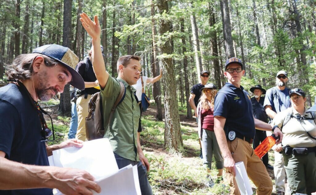


At 9 a.m. on Tuesday morning, August 20, Trustees and members of the Planning Commission met for a work session to discuss three new proposed routes for a Big Springs Emergency Egress Route. Attendees walked the Big Springs subdivision in order to fully assess the ecological concerns and geological considerations for each route.
Members of Nederland’s engineering consultants JVA led the meeting, including Project Manager Nathan Skalak, Senior Project Engineer Matt Gardner, and Senior Designer John Jordan. JVA has been the principal consultant on this project since 2016; the Town has been pursuing an emergency egress route for Big Springs for more than 20 years.
The meeting began at the Nederland Community Center, with Skalak providing a presentation on the history of the project, the previously studied routes, and the three new routes.
Skalak explained that a grant from the Federal Emergency Management Agency (FEMA) was awarded to the Town to fund either the construction of an emergency egress route or the planning for the route.
As none of the six routes previously studied by JVA were accepted, the result of many complications including geography, environmental factors, concerns over fire behavior, and private property issues, the grant was used to fund planning for three new routes.
JVA’s guiding principles for the route state that it should be a 12-foot-wide gravel surface with a two-foot shoulder on either side and a maximum longitudinal slope of 12%. The route should include pull-outs for fire engines every 400 feet and provide a 30-foot minimum turning radius.
The principles also state that construction of the route should involve a minimal amount of earthwork, and should avoid impacting any wetland and riparian environments, as well as any wildlife and residents.
The three new routes, named East Route 1, East Route 2, and the Boulder Canyon Route, focus on an eastern trajectory, considering that Big Springs has two access points on the west end. Each route was rated by JVA based on its safety, feasibility, projected cost, and impact on the environment and on the community.
Members of the Board of Trustees, the Planning Commission, the Parks, Recreation, and Open Space Advisory Board, the Nederland Downtown Development Authority, and the Nederland Fire Protection District, as well as Town staff and rangers from Boulder County, carpooled to Doe Trail to walk the potential routes.
These routes have not yet been finalized or approved; intensive community engagement is planned once JVA and fire professionals have completed their assessments and provided data on the ideal route. After community input, once a route is approved the Town will expedite securing funding for the construction of that route.
Residents of Doe Trail were also present and allowed the group to enter the forest on their property in order to access the potential entry point of all three routes. Skalak discussed with Fire Marshal Andrew Joslin and Fire Chief Charlie Schmidtmann the angle and incline necessary for a 30-foot utility truck at the entry point.
East Route 1 begins at Doe Trail and travels a 303-foot elevation gain to end at Magnolia Road. The route has several steep inclines and would require tight turns and travels through dry, unhealthy Boulder County forest, greatly in need of mitigation.
Walking the route led to a conversation about the project requiring an agreement with the County and/or with the U.S. Forest Service to fund mitigation efforts by a third party.
East Route 2 also begins at Doe Trail, but does not have as intense an elevation gain, having a maximum grade of 8.83%. The route was noted to be longer than Route 1 and traveled through healthier forest.
This route was not considered ideal as it is longer, and because it is lower down on the ridge, which would not only make it difficult for firefighters to keep an eye on fire behavior, but could potentially lead to a “chimney effect,” causing high heats and thick smoke. Concern was also raised about the route possibly affecting the popular Star Wars trail.
Originally, JVA had rated the Boulder Canyon Route low in terms of its viability, mostly because of the difficulty in its engineering. The route begins at Doe Trail and is planned to curve further east around the reservoir to connect to the access road at the bottom of Barker Dam, bringing those evacuating to Boulder Canyon Drive.
Joslin and Schmidtmann, though offering general support to the Town for constructing a route, were most in support of the Boulder Canyon Route.
Though constructing the route would be an engineering challenge, JVA was in agreement with the representatives of the NFPD that the egress route having a downhill trajectory and connecting to a paved highway would be ideal. Rangers from Boulder County also agreed that the Boulder Canyon Route was best as it involves less mitigation effort.
The route would potentially travel through a ravine, with culverts to be installed for natural draining. Other challenges include the final stretch of the route, which is steep and would run through City of Boulder property as well as private property.
No decisions were made during the work session, though JVA received useful feedback and gained important data in order to move forward with a final determination on the three routes. One route will be chosen and will be presented to the community for reaction. Follow The Mountain-Ear for more updates as this project progresses.


